
About Jamui District
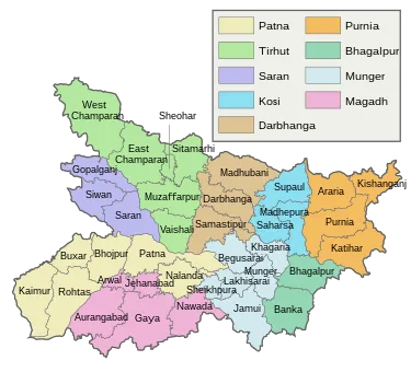
 Administrative System/Division Of Jamui District
The Jamui district is further divided in to Subdivisions / Blocks / Community Development Blocks (C.D.Blocks) for administrative
purposes. In India, the Block or C.D.Block is often the next level of administrative division after the tehsil. It is important to note that, In some states of India C.D.Blocks are equal to tehsils.
Gram Panchayats, Local administrative unit
For those who don’t know, the C.D.Block is a rural area earmarked for administration and development in India. The area is administered by a BDO (Block Development Officer). A C.D.Block covers several gram panchayats, local administrative unit at the village level. Official Website Of Jamui District is:
 Jamui.nic.in
Largest Subdivision Of Jamui District
Chakai is the largest subdivision in jamui district by area while Jhajha is the largest subdivision by population. Gidhaur is the smallest subdivision in jamui district by both area and population. There are 10 subdivisions in Jamui district. Here is the list of all Jamui Subdivisions / Blocks / C.D.Blocks along with area & population information.List of all Jamui Subdivisions / Blocks / C.D/Tehsils/Prakhand.
Only in the state of West Bengal are CD blocks considered the third-level administrative units (equal to tehsils in North India. Elsewhere, tehsils are also called Talukas in the Western Indian states of Goa, Gujarat, Maharashtra and South Indian states of Karnataka, Kerala, and Tamil Nadu.
In Arunachal Pradesh and Nagaland, the term Circles are used, while Subdivisions are present in the Eastern Indian states of Bihar, Jharkhand, Assam, and most of Northeast India (Manipur, Meghalaya, Mizoram, Sikkim and Tripura).
In Andhra Pradesh and Telangana, a newer form of the administrative unit called Mandals has replaced the Tehsil. Gujarat has a different structure, district collector or Divisional Magistrate, then Sub or sub-divisional Magistrate SDM i.e. Deputy Collector administering two or mote talukas. then sub or sub-division is divided into taluks.
Here Below the List of all Jamui Subdivisions / Blocks / C.D/Tehsils/Prakhand  .
.
| # | Subdivision (CD Block) | Area (km²) | Population (2011) |
|---|---|---|---|
| 1 | Barhat | 243 | 92,207 |
| 2 | Chakai | 826 | 2,35,188 |
| 3 | Gidhaur | 75 | 77,558 |
| 4 | Islamnagar Aliganj | 172 | 1,36,768 |
| 5 | Jamui | 176 | 2,32,114 |
| 6 | Jhajha | 478 | 2,67,504 |
| 7 | Khaira | 548 | 2,35,761 |
| 8 | Lakshmipur | 183 | 1,24,149 |
| 9 | Sikandra | 97 | 1,48,711 |
| 10 | Sono | 300 | 2,10,445 |
How many Population of Jamui District
| Particulars | Density | Male Population | Female Population | Total Population |
|---|---|---|---|---|
| Rural | 530 / km² | 8,39,776 | 7,75,296 | 16,15,072 |
| Urban | 3,030 / km² | 76,288 | 69,045 | 1,45,333 |
| Total | 568 / km² | 9,16,064 | 8,44,341 | 17,60,405 |
How many Households in Jamui District
Rural Households | Urban Households | Total Households |
|---|---|---|
2,82,205 | 24,877 | 3,07,082 |
Population Density Of Jamui District
| District Overview | |
| District (Hindi) : | Jamui (जमुई ) |
| State / UT : | Bihar |
| Total Area : | 3,098 km² |
| Total Population : | 17,60,405 |
| Density : | 568/km² |
| Total Subdivisions : | 10 |
| Total Villages : | 1,324 |
How Many Villages in Jamui District
There are about villages in Jamui subdivision, which you can browse from Jamui subdivision villages list (along with gram panchayat information) below.
| Total Population | Villages in Jamui District |
| less Than 200 | 288 |
| 200 – 499 | 312 |
| 500 – 999 | 284 |
| 1000 – 1999 | 205 |
| 2000 – 4999 | 178 |
| 5000 – 9999 | 48 |
| 10000 and above | 9 |